| Deployment ID | Status | Deployment Latitude | Deployment Longitude | Deployment Date | Recovery Date | Data Quality |
|---|---|---|---|---|---|---|
| ADRIFT_002 | Complete | 37.38 | −122.39 | 2021-06-09 18:38:00 | 2021-06-29 23:58:00 | compromised |
| ADRIFT_003 | Complete | 37.97 | −123.50 | 2021-07-25 18:33:00 | 2021-08-03 16:04:00 | compromised |
| ADRIFT_005 | Complete | 37.64 | −123.32 | 2021-06-10 18:30:00 | 2021-06-24 16:51:00 | compromised |
| ADRIFT_006 | Complete | 38.13 | −123.54 | 2021-07-25 19:11:00 | 2021-07-28 22:24:00 | compromised |
| ADRIFT_007 | Complete | 37.84 | −123.42 | 2021-06-10 16:49:00 | 2021-06-24 15:46:00 | compromised |
| ADRIFT_008 | Failed | 37.14 | −122.96 | 2021-06-09 | – | unusable |
| ADRIFT_010 | Failed | 37.80 | −123.39 | 2021-09-25 20:56:00 | 2021-10-14 | unusable |
| ADRIFT_011 | Failed | 37.64 | −123.13 | 2021-09-25 19:36:00 | 2021-10-15 | unusable |
| ADRIFT_015 | Complete | 37.96 | −123.50 | 2022-06-18 07:48:00 | 2022-06-21 06:39:00 | compromised |
| ADRIFT_016 | Unusable | 37.80 | −123.38 | 2022-06-16 22:37:00 | 2022-06-21 03:25:00 | unusable |
| ADRIFT_027 | Complete | 37.90 | −123.44 | 2022-07-26 18:27:00 | 2022-07-30 18:38:00 | good |
| ADRIFT_028 | Complete | 37.89 | −123.38 | 2022-07-26 17:05:00 | 2022-07-30 18:24:00 | good |
| ADRIFT_034 | Complete | 38.05 | −123.56 | 2022-09-27 17:43:00 | 2022-10-01 16:45:00 | good |
| ADRIFT_035 | Unusable | 38.13 | −123.53 | 2022-09-26 17:55:00 | 2022-10-01 18:00:00 | unusable |
| ADRIFT_066 | Unusable | 37.72 | −123.23 | 2023-05-08 03:08:00 | 2023-05-13 20:51:00 | unusable |
| ADRIFT_067 | Complete | 37.80 | −123.38 | 2023-05-08 04:18:00 | 2023-05-12 01:46:00 | compromised |
| ADRIFT_092 | Complete | 37.72 | −123.23 | 2023-09-17 17:42:00 | 2023-09-22 01:48:00 | compromised |
ACCESS Survey
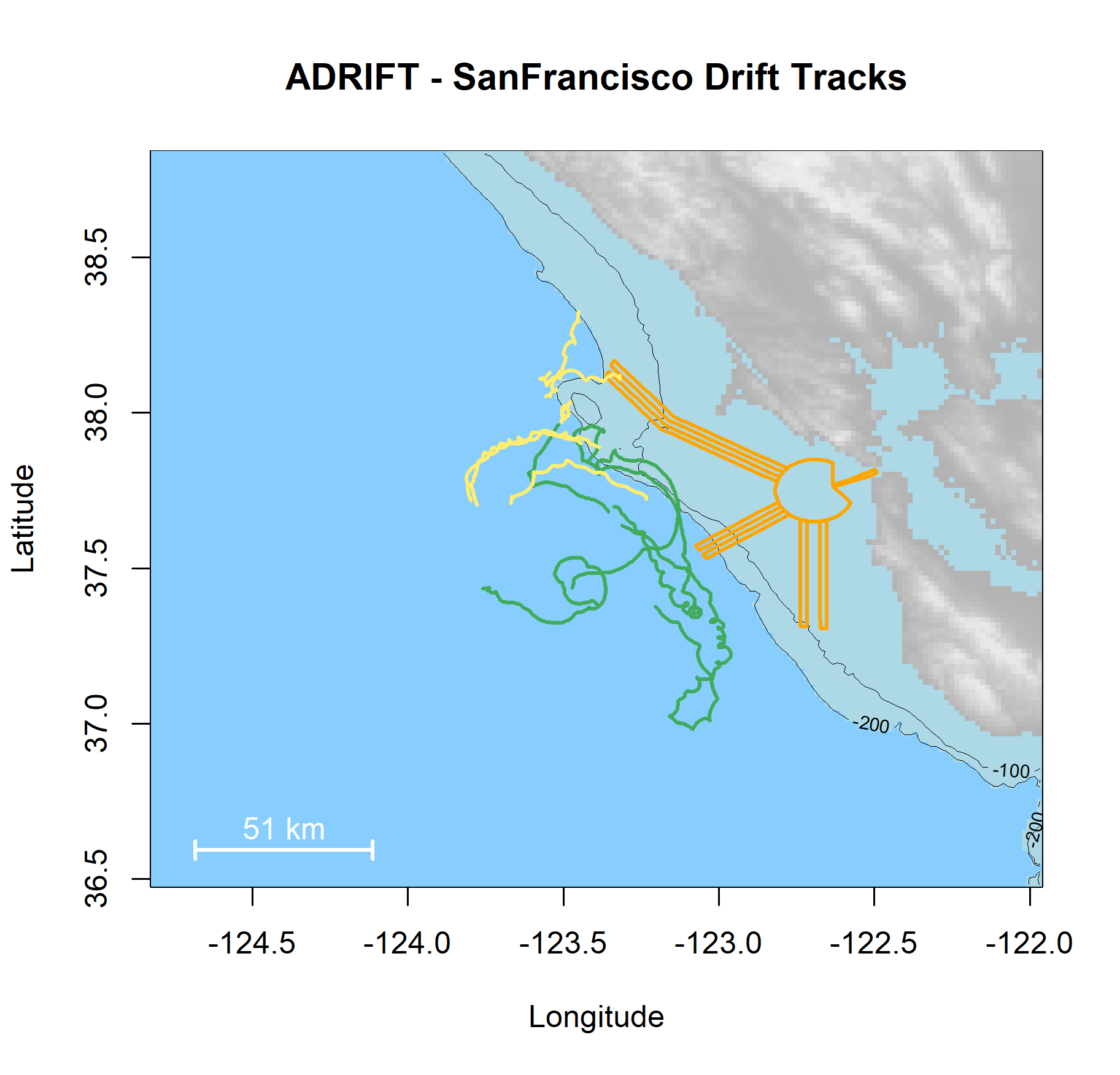
The Applied California Current Ecosystem Studies (ACCESS) surveys provide an opportunity to deploy drifting recorders to monitor the waters offshore San Francisco Bay. This report complements the final Adrift report with specific focus on the Adrift-ACCESS data collection efforts within these NOAA Sanctuaries.
A total of 17 drifting recorders were deployed during the upwelling and post-upwelling seasons.
Specific objectives of the Adrift-ACCESS surveys include:
Determine the viability and value of coordinated drifting recorder PAM monitoring during ACCESS Surveys
Identify marine mammal species encountered within the Greater Farallones and Cordell Bank National Marine Sanctuaries
Provide additional information on the detection of fin and blue whales within and offshore the Greater Farallones and Cordell Bank National Marine Sanctuary
A summary table of Adrift-ACCESS deployments are shown below. Additional deployment details are provided in the Expanded Datasets for Adrift.